
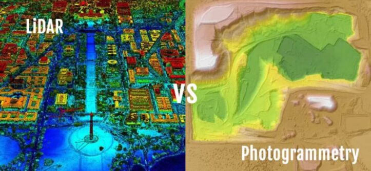
Imagine creating a detailed 3D map of a forest or a city. You need accuracy, speed, and cost-effectiveness. Two technologies dominate this space: LiDAR vs. photogrammetry. Both create 3D models, but they work differently. Which one suits your project? This article breaks it down.
LiDAR uses laser pulses to measure distances. Photogrammetry relies on photographic images. Each has unique strengths. According to a 2023 USGS report, LiDAR achieves vertical accuracy up to 10 cm. Photogrammetry, per a 2022 study by the American Society for Photogrammetry and Remote Sensing, offers horizontal accuracy within 5 cm. Let’s explore how they compare and help you decide.
What is LiDAR?
LiDAR stands for Light Detection and Ranging. It uses laser beams to map environments. A LiDAR sensor emits laser pulses. These pulses bounce off objects and return. The system calculates distances based on the time taken. This creates a point cloud, a collection of 3D data points.
LiDAR sensors, like the DJI L1 or Livox LiDAR module, are common in drone surveying. They excel in capturing elevation data and vegetation penetration. LiDAR is active capture technology. It works in low-light conditions or at night. This makes it ideal for complex environments like forests or urban areas.
Key Features of LiDAR
- Accuracy: Achieves high vertical accuracy (up to 10 cm).
- Speed: Captures millions of points per second.
- Penetration: Sees through vegetation for ground-level data.
- Versatility: Works in low light or dense environments.
What is Photogrammetry?
Photogrammetry uses photographic images to create 3D models. Cameras, like those on the Phantom 4 RTK or Pro3 camera, capture overlapping images. Software, such as Global Mapper, stitches these images together. It analyzes pixel data to calculate distances and generate 3D point clouds.
Photogrammetry relies on RGB cameras or mobile phones for image capture. It’s a passive measurement technique, needing good lighting. Drone photogrammetry is popular for creating orthomosaic maps and digital surface models. It’s cost-effective and widely used in construction planning and city mapping.
Key Features of Photogrammetry
- Cost-Effective: Uses standard cameras or drones.
- Detail: Produces high-resolution, colorized point clouds.
- Flexibility: Works with aerial imagery or ground-based photos.
- Ease of Use: Software simplifies data processing.
How LiDAR and Photogrammetry Work
LiDAR Workflow
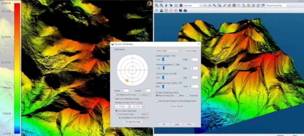
LiDAR systems emit laser pulses from devices like laser scanners or UAV platforms. These pulses hit surfaces and reflect back. The system records the time and angle of each pulse. This data forms a 3D point cloud. Inertial Measurement Units and GNSS data ensure accuracy. Software processes the point cloud into digital terrain models or 3D maps.
For example, the Leica BLK360 scanner captures precise data for infrastructure planning. LiDAR’s point density allows detailed mapping of power lines or utility poles. It’s ideal for forest inventory or environmental monitoring.
Photogrammetry Workflow
Photogrammetry starts with capturing geotagged photographs. Drones like the M300 RTK use Smart Oblique Capture for efficiency. Software analyzes image overlap to calculate spatial data. It generates 3D point clouds, orthomosaic maps, or digital elevation models. Ground control points improve accuracy.
Photogrammetry shines in creating digital twins for industrial sites or emergency and search and rescue missions. Its RGB value adds visual clarity to 3D models.
Comparing LiDAR and Photogrammetry: Key Differences
Both technologies create 3D data, but their methods differ. Here’s a breakdown:
- Technology Type:
- LiDAR: Active capture using laser beams.
- Photogrammetry: Passive capture using photographic images.
- Accuracy:
- LiDAR: High vertical accuracy for elevation data.
- Photogrammetry: Superior horizontal accuracy for detailed surfaces.
- Lighting Conditions:
- LiDAR: Works in low light or darkness.
- Photogrammetry: Requires good lighting for clear images.
- Cost:
- LiDAR: Expensive due to specialized LiDAR sensors.
- Photogrammetry: Affordable with standard cameras or drones.
- Data Output:
- LiDAR: Dense point clouds with elevation focus.
- Photogrammetry: Colorized point clouds with visual detail.
- Applications:
- LiDAR: Vegetation penetration, power line surveys, forest inventory.
- Photogrammetry: City mapping, construction planning, digital twins.
Strengths and Weaknesses
LiDAR Strengths
- Penetrates vegetation for accurate ground data.
- Works in low-light or cloudy conditions.
- High point density for detailed 3D point clouds.
- Ideal for large-scale surveying projects.
LiDAR Weaknesses
- High cost of LiDAR technology.
- Complex data processing requires expertise.
- Limited color data in point clouds.
Photogrammetry Strengths
- Cost-effective with accessible tools.
- Produces visually rich, color-compatible models.
- Easy to use with photogrammetry software.
- High horizontal accuracy for surface details.
Photogrammetry Weaknesses
- Needs good lighting for quality images.
- Less effective in dense vegetation.
- Processing time increases with image volume.
Applications of LiDAR and Photogrammetry
Both technologies serve diverse industries. Here’s how they’re used:
LiDAR Applications
- Environmental Monitoring: Maps forests and tracks habitat fragmentation. The Latvian State Forest Research Institute “Silava” uses LiDAR for forest inventory.
- Infrastructure Planning: Surveys power lines and utility poles for regulatory compliance.
- Drone Surveying: DJI L1 LiDAR modules map terrain with high accuracy.
- Emergency Response: Creates 3D maps for search and rescue missions.
Photogrammetry Applications
- City Mapping: Generates orthomosaic maps for urban planning.
- Construction Planning: Creates digital terrain maps for site analysis.
- Drone Photogrammetry: Phantom 4 RTK drones map large areas efficiently.
- Digital Twins: Builds detailed models for industrial sites or heritage preservation.
Case Studies
LiDAR in Action
A 2024 project in California used LiDAR for power line surveys. Drones equipped with DJI L1 sensors mapped 500 miles of power lines. The system detected vegetation encroachment with 10 cm accuracy. This ensured compliance with safety regulations. The project saved 30% in time compared to traditional methods.
Photogrammetry in Action
In 2023, a UK construction firm used drone photogrammetry for a housing project. A Phantom 4 RTK drone captured aerial imagery. Software created a digital surface model. The model guided site planning with 5 cm accuracy. The firm reduced surveying costs by 40%.
Read Also:
Six Weeks Holiday Vs Website Redesign
What Does a Red Snapchat Heart Mean?
Choosing the Right Technology for Your Project
Consider your project’s needs. Here’s a guide:
- Choose LiDAR if:
- You need vegetation penetration.
- Your project requires high vertical accuracy.
- You work in low-light or complex environments.
- Budget allows for specialized equipment.
- Choose Photogrammetry if:
- You need cost-effective solutions.
- Visual detail and color are important.
- You work in well-lit, open areas.
- You prioritize horizontal accuracy.
For example, use LiDAR for forest inventory or power line surveys. Choose photogrammetry for city mapping or construction planning.
Cost and Accessibility
LiDAR systems, like the Leica BLK360, cost $15,000–$50,000. Drone-based LiDAR, like the M300 RTK with a Livox LiDAR module, is slightly cheaper but still expensive. Photogrammetry uses affordable tools. A Phantom 4 RTK drone costs $6,000–$8,000. Mobile phones or RGB cameras lower costs further.
Cloud-based platforms, like Global Mapper, simplify data processing for both. Photogrammetry software is often cheaper and more user-friendly. LiDAR requires specialized skills, increasing labor costs.
Future Trends in LiDAR and Photogrammetry
Both technologies are evolving. LiDAR sensors are becoming smaller and cheaper. The Livox LiDAR module, for instance, is compact yet powerful. Photogrammetry benefits from computer vision advancements. Smart Oblique Capture improves image efficiency. Hybrid systems combining LiDAR and photogrammetry are emerging. These create highly accurate, colorized point clouds.
A 2025 report predicts drone technology will dominate 3D mapping. UAV platforms will integrate LiDAR and photogrammetry for versatile solutions. Cortex AI and other tools will streamline data processing.
Make the Right Choice
LiDAR and photogrammetry both create 3D models. LiDAR excels in accuracy and vegetation penetration. Photogrammetry offers affordability and visual detail. Your project’s needs determine the best choice. Need elevation data in dense forests? Go with LiDAR. Want cost-effective city mapping? Choose photogrammetry.
Ready to start? Assess your budget, environment, and goals. Contact a drone surveying expert or explore tools like Global Mapper. Your perfect 3D map is just a project away!
FAQs
What is the main difference between LiDAR and photogrammetry?
LiDAR uses laser pulses for active capture. Photogrammetry uses photographic images for passive capture.
Which is more accurate, LiDAR or photogrammetry?
LiDAR offers better vertical accuracy. Photogrammetry excels in horizontal accuracy.
Can LiDAR and photogrammetry be used together?
Yes. Hybrid systems combine both for accurate, colorized 3D models.
What are the costs of LiDAR vs. photogrammetry?
LiDAR systems cost $15,000–$50,000. Photogrammetry uses drones or cameras costing $1,000–$8,000.
Which is better for drone surveying?
LiDAR suits complex terrains. Photogrammetry is ideal for visual mapping in open areas.
References
- USGS LiDAR Accuracy Report: https://www.usgs.gov/3d-elevation-program
- American Society for Photogrammetry and Remote Sensing: https://www.asprs.org/
- DJI L1 LiDAR Module: https://www.dji.com/l1
- Phantom 4 RTK Drone: https://www.dji.com/phantom-4-rtk
- Global Mapper Software: https://www.bluemarblegeo.com/global-mapper/


Leave a Reply